Hyperspectral imaging for military surveillance: airborne vs satellite


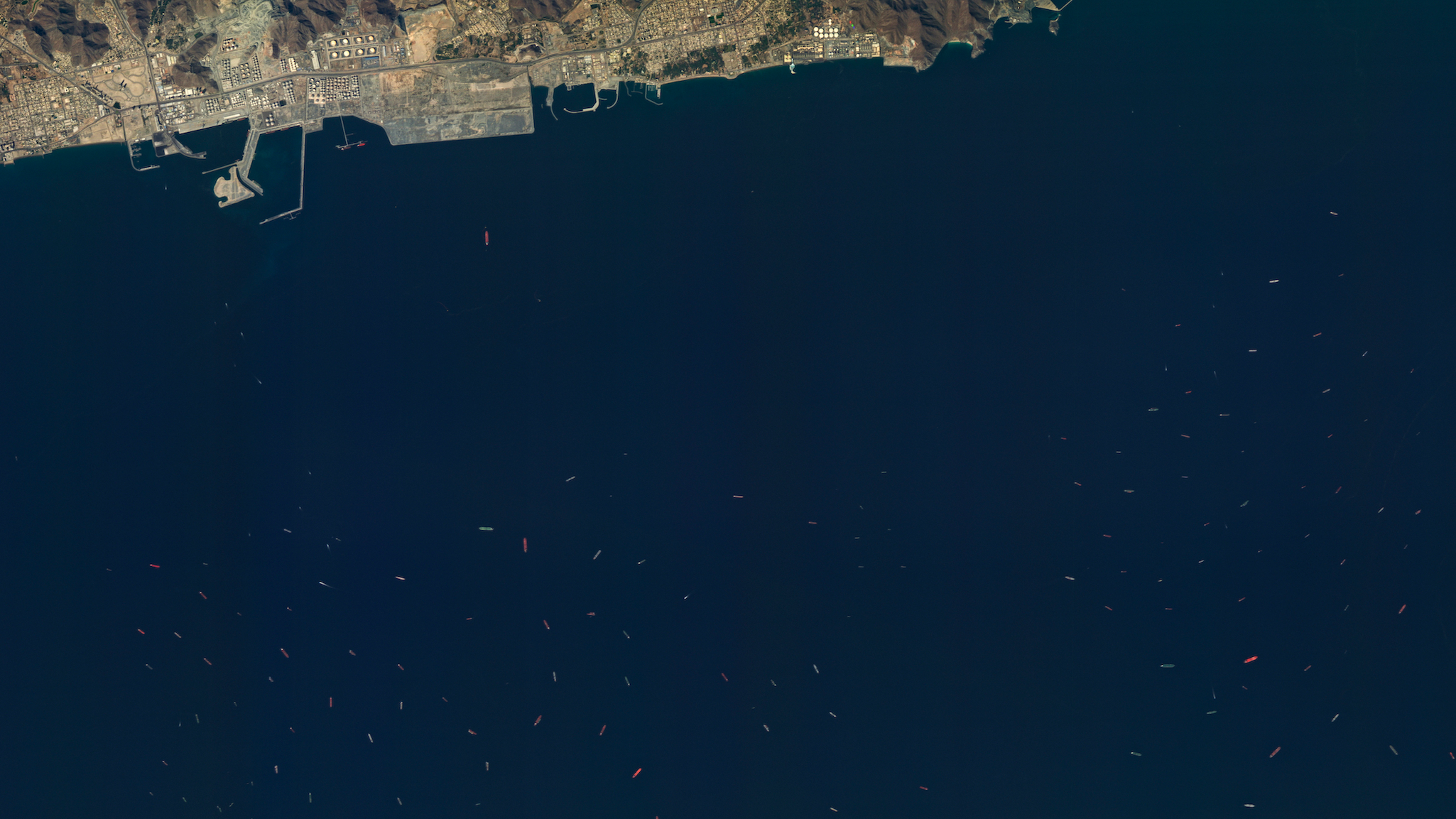
The biggest gap in maritime surveillance
While there is still a role for conventional technology, legacy sensors leave a critical blind spot in maritime defence:
- Material distinction: conventional sensors cannot identify what a target is made of.
- Camouflage detection: conventional sensors cannot distinguish camouflaged assets from natural background.
- Spectral signatures: conventional sensors cannot detect chemical and material signatures that indicate intent or composition.
To close the gap, defence organizations must rely on hyperspectral imaging. Hyperspectral imaging compliments how radar reveals shape and motion, and how EO/IR cameras capture visual and thermal imagery, by providing more data to make decisions from.
Why use hyperspectral imaging in defence
Hyperspectral systems capture reflected light across dozens or hundreds of narrow spectral bands in a continuous fashion across the spectral range of the sensor, producing a unique fingerprint for every material in the scene. The result is a sensing modality that can:
- detect concealed or camouflaged targets,
- identify vessel hull coatings,
- classify vegetation stress caused by underground activity, and,
- discriminate between real equipment and decoys.
What does this mean to your business when selecting your next sensor?
If you are a procurement official or programme manager evaluating hyperspectral as your next ISR investment, the question really is which delivery platform provides the most effective, scalable, and cost-efficient access: a manned or unmanned airborne (or UAS) system, or a satellite constellation.
Side-by-side: satellite vs airborne (or UAS) hyperspectral
The table below compares the two primary delivery platforms. Each has clear strengths. The right choice depends on operational requirements, programme budget, theatre of operations, and mission scope.
The pattern is clear. Airborne hyperspectral provides unmatched spatial detail for localized, time-sensitive missions. Satellite hyperspectral provides scalable, and global coverage that modern defence doctrine demands. For most strategic surveillance programmes, the satellite constellation is the more cost-effective foundation, with airborne assets reserved for tactical augmentation when sub-metre resolution is required.
Decision framework: choosing the right platform
For defence planners evaluating hyperspectral investment, the decision between airborne and satellite is not binary. Both platforms have a role, and the strongest ISR architectures combine them. The framework below helps determine which should serve as the primary capability and which as a tactical complement.
For most national-level defence programmes, a satellite constellation provides the foundation: frequent, global, scalable, and cost-effective at wide-area coverage. Airborne assets then serve as tactical complements, deployed for high-resolution, time-sensitive collection over specific areas that satellite cueing has identified as priorities.
The operating principle is straightforward. Satellite hyperspectral data identifies where to look. Airborne assets zoom in on what matters. Together, they deliver an ISR capability that is greater than either platform can achieve alone.
See how hyperspectral fits your mission
Wyvern operates 5 hyperspectral satellites today, delivering 31-band VNIR imagery at 5 m ground sampling distance to defence and commercial customers worldwide. Our new ship identification product is purpose-built for maritime domain awareness, and our analysis-ready data integrates directly into existing C4ISR workflows through standard APIs.
Book a technical consultation to explore how satellite hyperspectral data strengthens your surveillance architecture: wyvern.space/contact
1Zhang, Y. et al. Research on Camouflage Recognition in Simulated Operational Environment Based on Hyperspectral Imaging Technology. Journal of Spectroscopy, 2021. https://www.hindawi.com/journals/jspec/2021/6629661/


Start using
hyperspectral imagery