Instructions
To make this component work follow these steps:
  1. Remove the delete-this-class class from the navbar14_component div. This will change the positioning of the navbar to fixed.
  2. Add the navbar-on-page class to the page-wrapper class. This will ensure that the navbar is centered on the page.
  3. Add the max-width-full class to the main-wrapper class. This will ensure all sections inside of the main wrapper are full-wdith.
Products
Hyperspectral imagery
Archive
Open Data
Technology
Industries
AgriculturePeace and securityForestry and ESGEnergyMining
Company
About usJoin us
Resources
Resource libraryKnowledge centre
Knowledge Centre
Product Guide
Open Data
Product guideOpen data
Partners
Contact Us
Order imagery
Peace and security

Enhanced mission intelligence

Uncover hidden risks across land, sea, and borders with timely, accurate information that strengthens situational awareness.

Talk to sales
Access the data

Respond rapidly to potential threats

Detect subtle material and environmental shifts early so you can assess faster and respond before situations escalate.

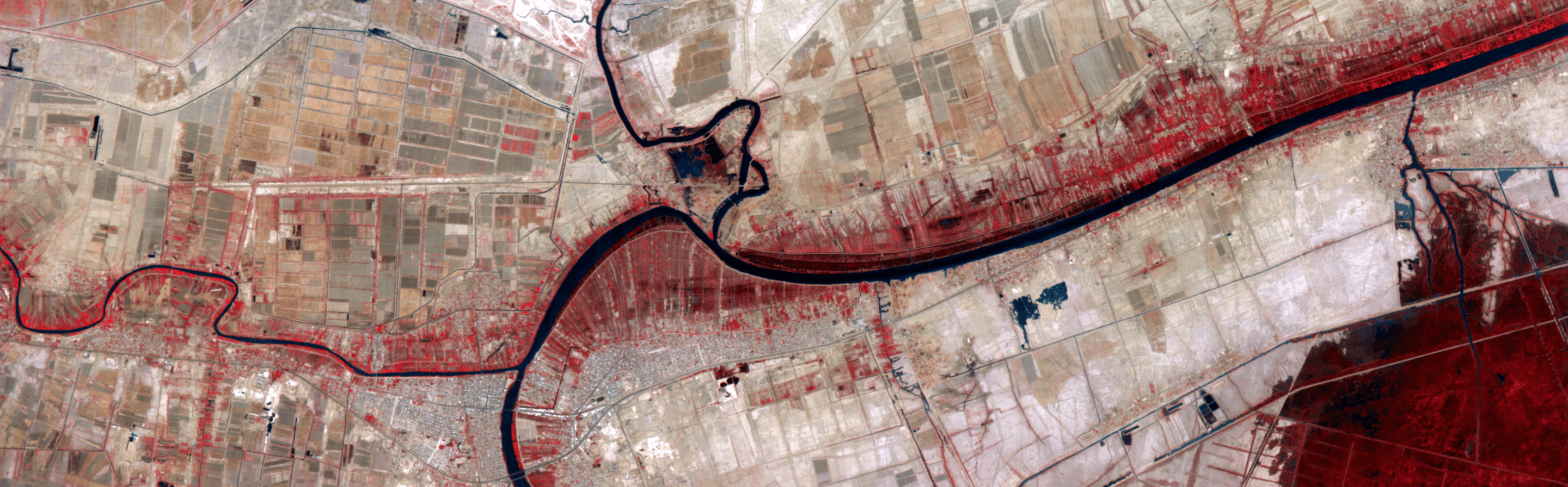
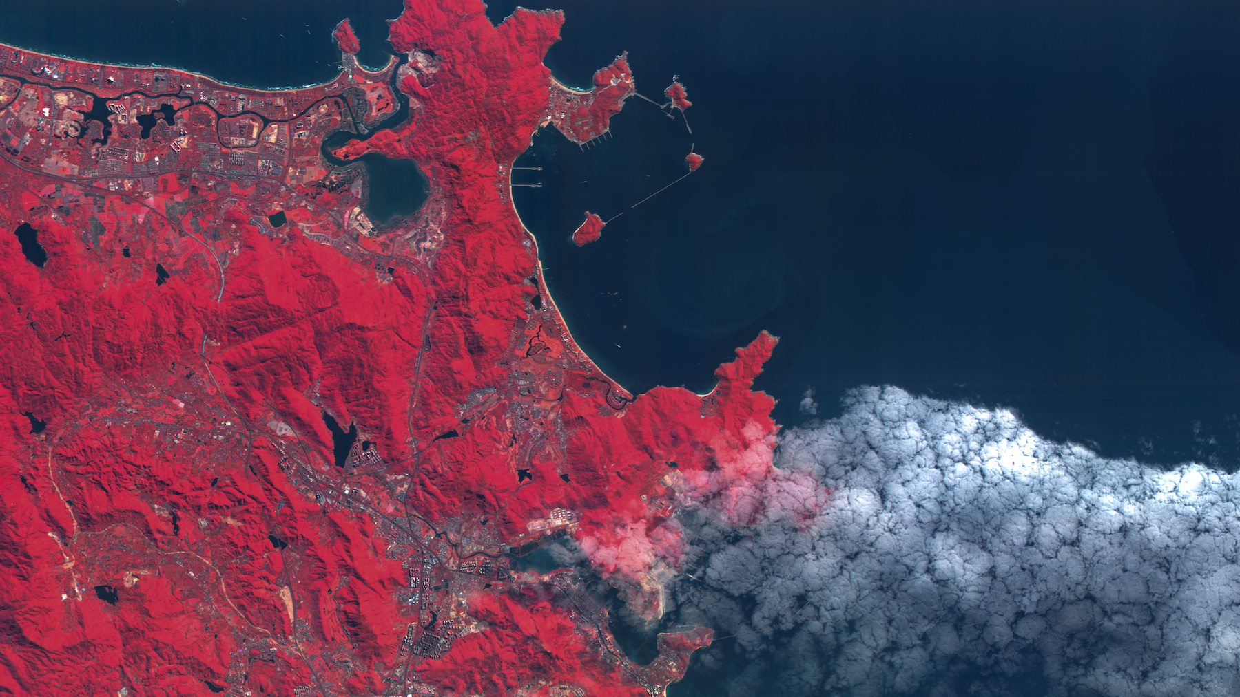
Analyze mixed terrain with precision

Clearly understand every component in a mixed land area, even when images contain multiple materials.

Safely monitor high-risk environments

Observe large or inaccessible areas remotely with repeatable, defensible measurements that support ongoing situational awareness.

Identifying marine vessels

Wyvern identifies marine vessels with high accuracy, using each ship’s unique spectral signature. By comparing hyperspectral observations with declared identity, our imagery supports detection and monitoring of AIS spoofing, and 
non-cooperative or dark vessels.

Distinguish vessels beyond shape and size

Pinpoint materials and paint pigments

Measure corrosion levels

Identify vessel operators

Learn more
Applications

Real-life solutions

Hyperspectral imagery reduces situational risk with detailed material-level insights.

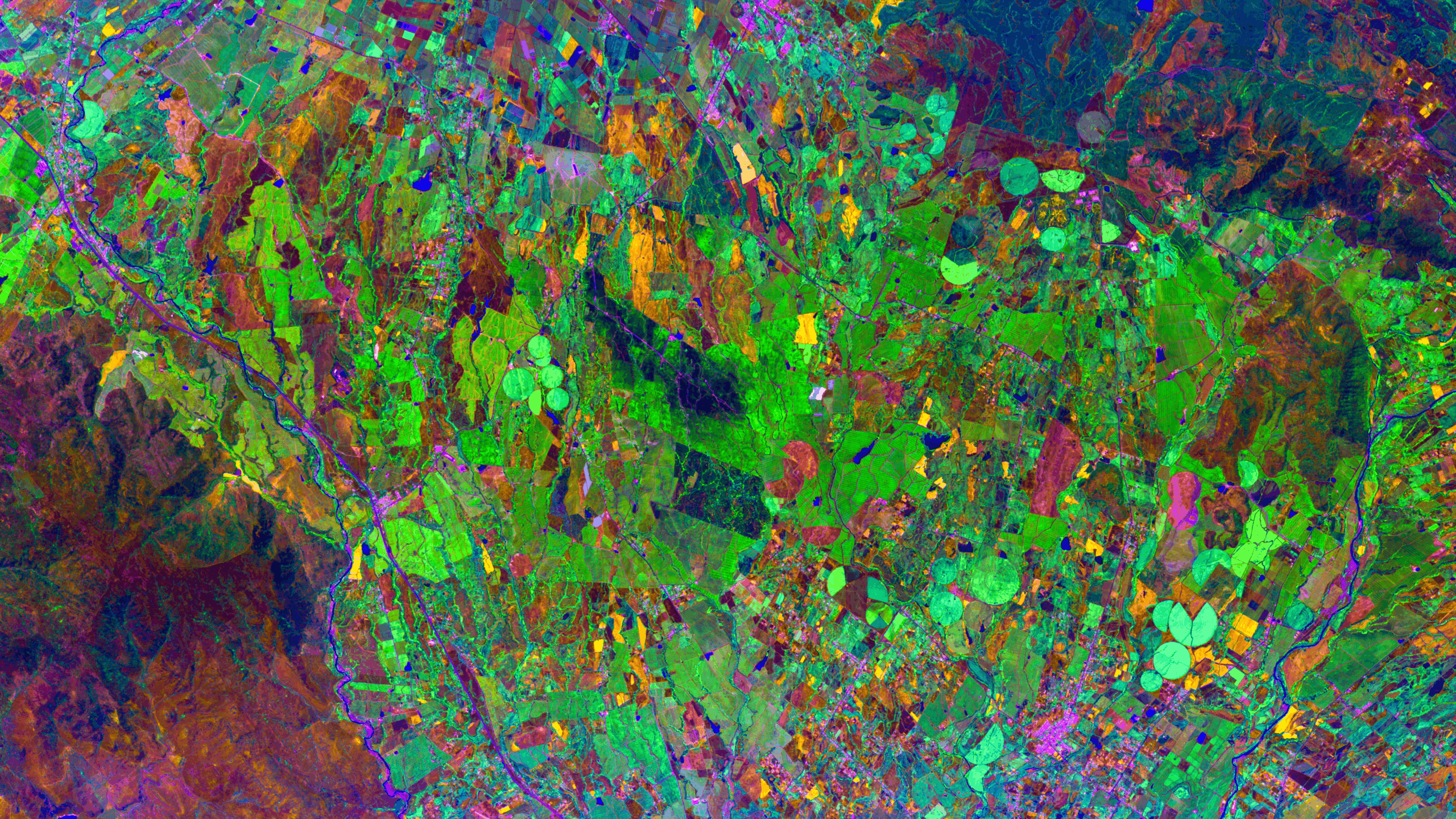
Material identification

Accurately identify and analyze surface materials to uncover activity and intent.

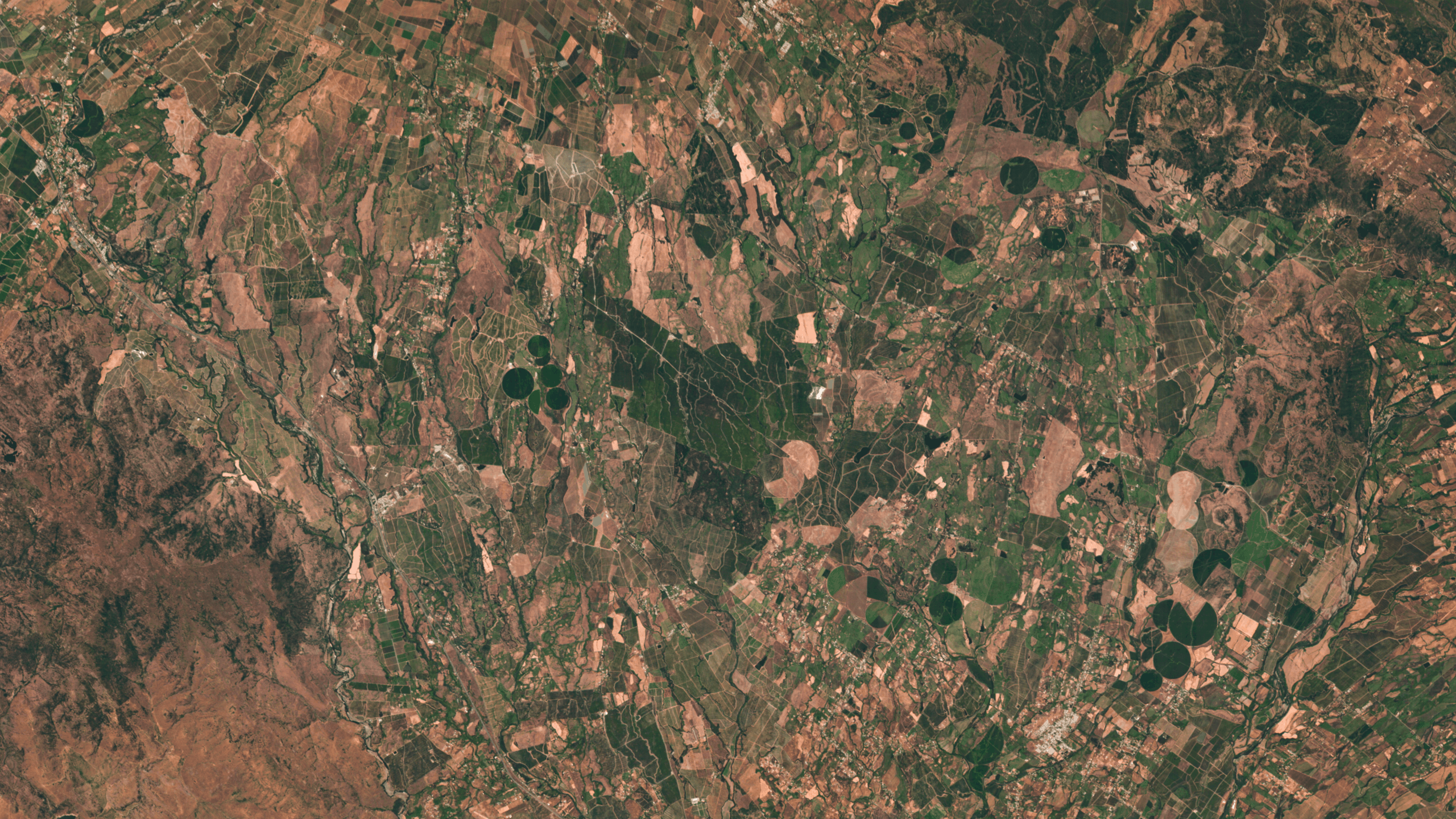
Camouflage detection

Reveal concealed assets that evade traditional imaging by measuring material differences.
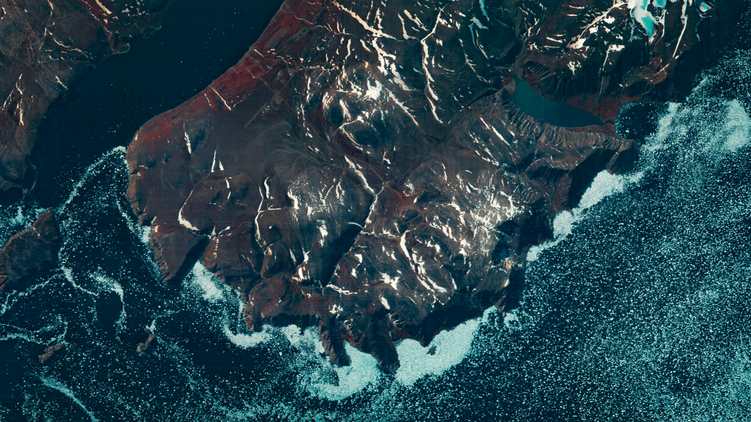
Remote surveillance

Monitor large or hard-to-access areas with consistent, reliable coverage.

Maritime domain awareness

Compare hyperspectral observations with AIS data to flag spoofing, misreporting, and non-cooperative or dark vessels.

Strategic facilities monitoring

Track material changes at important locations to optimize safety and longevity of assets.

Enhanced situational awareness

Integrate material-level insight into ISR workflows to reduce uncertainty and support decision-making.

Canadian government users can order imagery through our NMSO

Order now

The hyperspectral advantage

Hyperspectral imagery adds material-level discrimination to optical and radar data, clearly distinguishing look-alike objects and changes. This additional spectral dimension reduces ambiguity, supports correlation across data sources, and improves confidence in operational assessments.

Hyperspectral
Multispectral
Hyperspectral
Radar (SAR)
Optical
All-weather capability
Limited by cloud and lighting
All-weather, day/night
Limited by cloud and lighting
Spatial detail and context
Moderate spatial resolution with material context
Structural and surface roughness information
High spatial resolution and visual context
Material discrimination
Direct material and surface composition discrimination
Indirect inference from scattering behaviour
Limited, largely shape and colour based
Detection of subtle change
Detects chemical and material changes before visible effects
Detects structural and surface changes
Detects visible or structural change
Role in multi-sensor workflows
Attribution, characterization, and ambiguity reduction
Persistent monitoring and change detection
Identification and situational context
All-weather capacity
Hyperspectral

Limited by cloud and lighting

Radar (SAR)

All-weather, day/night

Optical

Limited by cloud and lighting

Spatial detail and context
Hyperspectral

Moderate spatial resolution with material context

Radar (SAR)

Structural and surface roughness information

Optical

High spatial resolution and visual context

Material discrimination
Hyperspectral

Direct material and surface composition discrimination

Radar (SAR)

Indirect inference from scattering behaviour

Optical

Limited, largely shape and colour based

Detection of subtle change
Hyperspectral

Detects chemical and material changes before visible effects

Radar (SAR)

Detects structural and surface changes

Optical

Detects visible or structural change

Role in multi-sensor workflows
Hyperspectral

Attribution, characterization, and ambiguity reduction

Radar (SAR)

Persistent monitoring and change detection

Optical

Identification and situational context

Our partners at PacGeo have decades of experience matching government departments with the right satellite data. Reach out for an objective assessment.

Contact pacgeo

Frequently Asked Questions

Expand all
Collapse all
What makes hyperspectral imagery valuable for defence and security applications?

Hyperspectral imagery measures material-level spectral signatures rather than relying on visual interpretation alone. This enables analysts to distinguish materials, surfaces, and subtle changes that may not be apparent in optical imagery, supporting improved attribution, anomaly detection, and situational understanding.

How does hyperspectral imagery complement SAR and high-resolution optical data?

Hyperspectral imagery is designed to be used alongside SAR and optical sensors. SAR provides all-weather detection and structural context, optical imagery delivers high spatial detail, and hyperspectral data adds material and compositional insight. Together, these sensors provide a more complete picture than any single modality alone.

Does hyperspectral imagery replace SAR or optical imagery?

No. Hyperspectral imagery does not replace SAR or optical sensors. It complements them by adding a distinct layer of material intelligence that enhances analysis, reduces ambiguity, and improves confidence when multiple data sources are fused.

What software is required to work with hyperspectral imagery?

Wyvern imagery integrates with standard geospatial software. No proprietary viewer is required.

How do defence users access Wyvern imagery?

Wyvern imagery can be accessed through secure delivery mechanisms and APIs. Access models can be tailored to mission requirements, security posture, and user clearance levels.

What if I don’t have the tools or expertise to analyze hyperspectral data?

Wyvern can support analysis either directly or through a network of trusted analytics and systems integration partners, depending on mission requirements, security constraints, and operational context. This enables defence users to receive mission-relevant insights without needing to use geospatial tools to extract insights themselves.

Are spectral libraries available?

Yes. Spectral libraries for specific materials can be made available where appropriate, subject to mission requirements, access controls, and security considerations. Please contact us to discuss availability and suitability for your use case.

How is data ownership, cybersecurity, and sovereignty handled?

Wyvern maintains strict data ownership and access controls aligned with government security requirements. Imagery is not resold or redistributed without authorization, and data handling practices are designed to support national sovereignty, secure processing environments, and controlled dissemination.

Resources

Related resources

View all

Blog title heading will go here

news
Sep 29, 2025

Blog title heading will go here

news
Sep 29, 2025

Blog title heading will go here

news
Sep 29, 2025

Blog title heading will go here

news
Sep 29, 2025

Blog title heading will go here

news
Sep 29, 2025

Blog title heading will go here

news
Sep 29, 2025

Dragonette-004: Hyperspectral intelligence from orbit

News
Nov 6, 2025

Dragonette-004: Hyperspectral intelligence from orbit

News
Nov 6, 2025

Wyvern and Nara Space partner to expand access to hyperspectral data across Asia

News
Sep 29, 2025

Wyvern and Nara Space partner to expand access to hyperspectral data across Asia

News
Sep 29, 2025

Breaking barriers and reaching for the stars: Celebrating women and girls in science at Wyvern

Insights
Feb 11, 2025

Breaking barriers and reaching for the stars: Celebrating women and girls in science at Wyvern

Insights
Feb 11, 2025
View all

Start using hyperspectral imagery

Mitigate risk in defence and security operations with material-level insight.
Book a call
Contact us
Products
Hyperspectral imageryArchiveOpen Data
Industries
AgriculturePeace and securityForestry and ESGEnergyMining
Company
Our technologyOur partnersAbout usJoin usContact us
Subscribe
Join our newsletter to stay up to date on all things Wyvern.
By subscribing you agree to with our Privacy Policy and provide consent to receive updates from our company.
Thank you! You are now subscribed!
Oops! Something went wrong while submitting the form.
© 2026 Wyvern Inc. All rights reserved.
Privacy Policy
We use cookies to enhance your experience.
Learn more
Accept