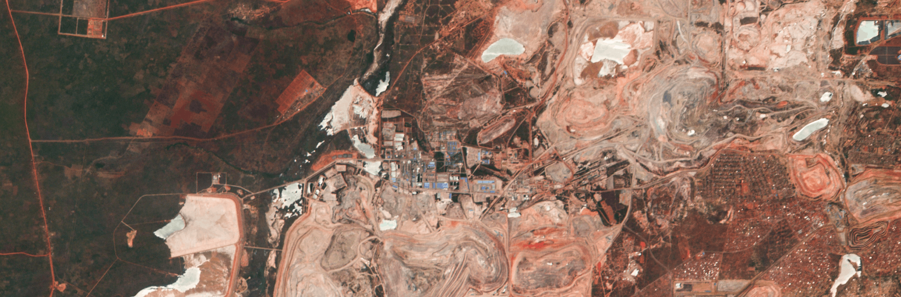
Streamlined mining operations
Hyperspectral images delivers close-up intelligence from afar—reducing site visits, lowering costs, and improving safety from early exploration to post-closure rehabilitation.
Reduce reliance on dense ground sampling
Complement dense ground sampling with continuous, site-wide, high-resolution coverage.
Analyze complex surfaces more accurately
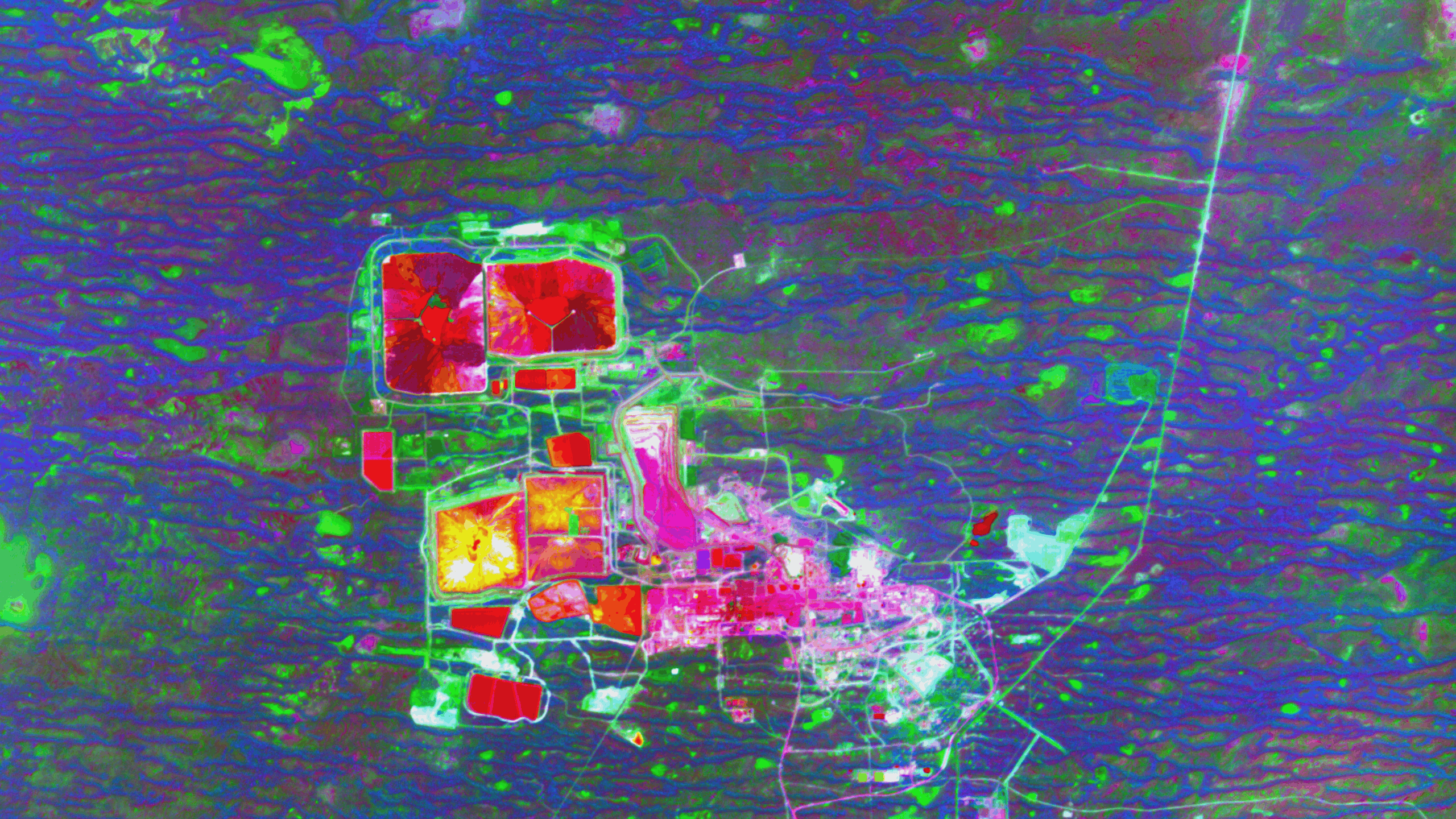
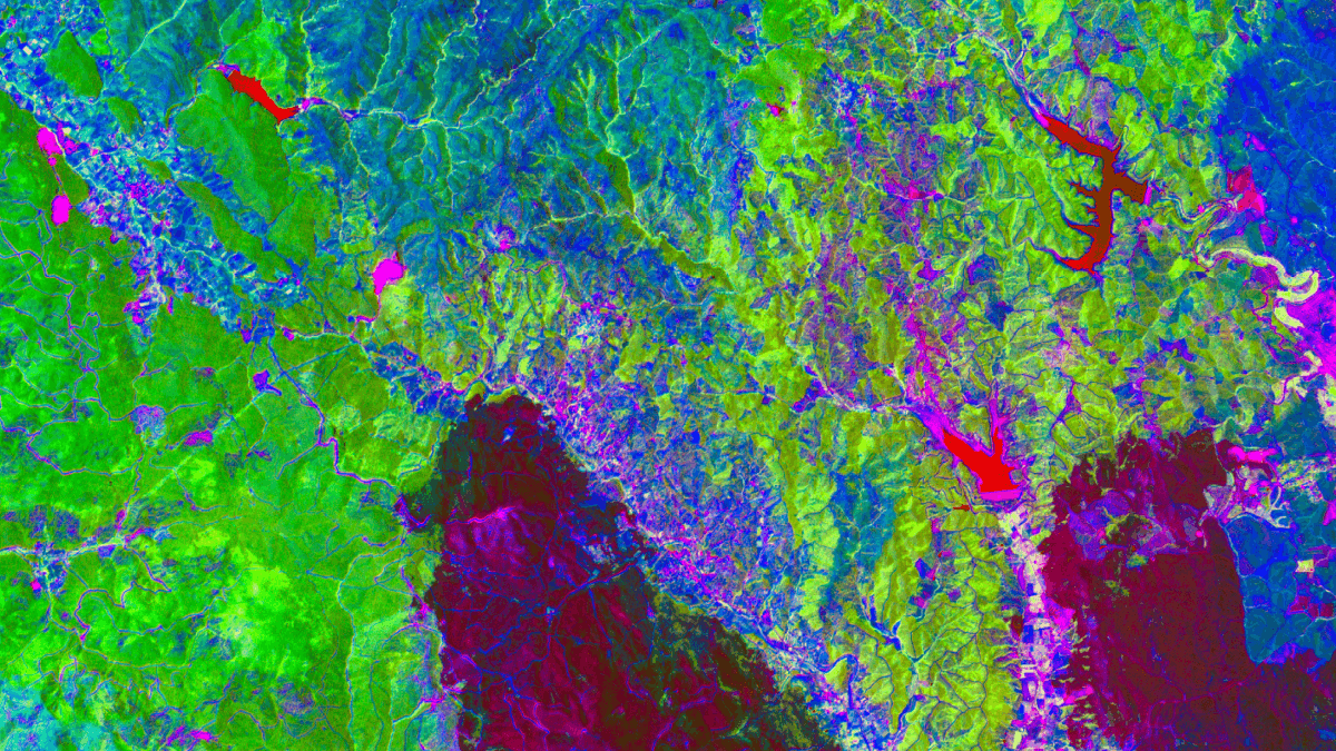
Clearly differentiate elements in mixed-material areas by using their unique spectral signatures.
Consistently monitor mining sites
Leverage repeatable data acquisition for accurate analysis of evolving operations.
AcceLerating site design
We work with organizations in the mining industry to plan sites more efficiently than ever before. Our hyperspectral imagery provides consistent, real-world context over a full area of interest, reducing uncertainty and optimizing site design before breaking any ground.
Earlier risk discovery
Reduced on‑ground survey time
A clear, auditable planning baseline
Fewer redesign loops
Lower planning costs
Real-life solutions
Hyperspectral imagery brings detailed insights to every stage of the mining lifecycle.
Target assessment
Identify mineral signatures remotely for faster, more focused exploration efforts.
Mine planning
Simplify site design with detailed material identification of cut and dump areas.
Environmental assessment
Continuously monitor large areas to proactively manage environmental impact.
Asset monitoring
Maximize asset performance, minimize downtime and optimize operational costs.
Change detection
Measure site evolution over time for timely, precise operational decisions.
Reclamation & Rehabilitation
Verify ecological and environmental indicators to support responsible site remediation.
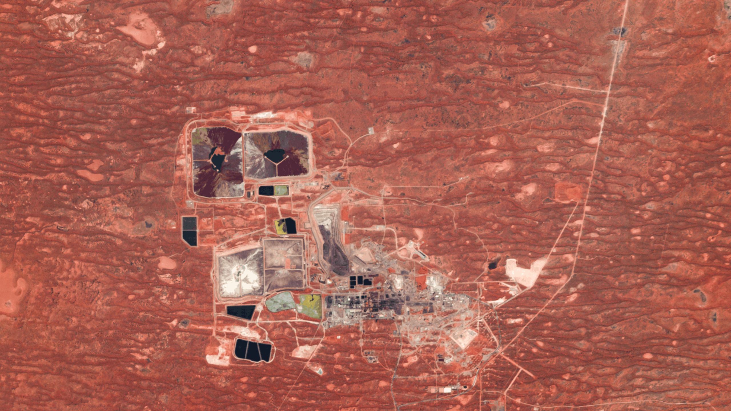
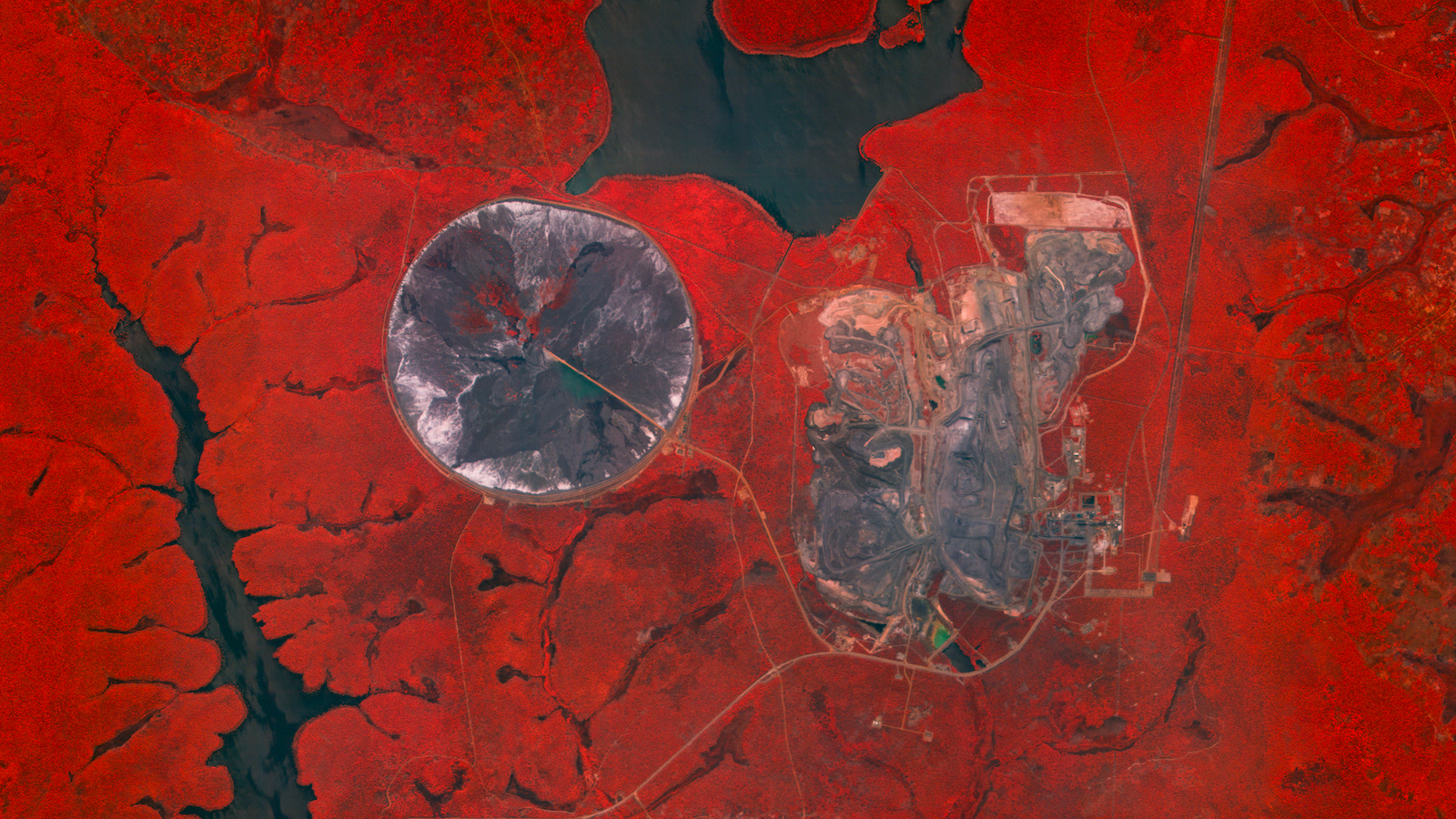
The hyperspectral advantage
Hyperspectral imagery captures the spectral signatures of materials, vegetation, and water to reveal early indicators of instability, seepage, stress, and change—far beyond what visual inspections detect. This continuous, site-wide intelligence supports proactive risk management, regulatory compliance, and long-term reclamation planning at scale.
Our next-generation satellites offer SWIR imaging—a transformative tool for the mining industry. Book a call to learn more.
Frequently Asked Questions
Our hyperspectral imagery supports tailings storage facility monitoring, vegetation health assessment, water quality monitoring, reclamation tracking, and material characterization across active and closed mine sites. While our current constellation (covering the VNIR region) cannot support many direct mineral detection and exploration applications, it can support with identification of some alteration minerals and improving the accuracy of modelling underground features.
Hyperspectral imagery captures many more narrow spectral bands, which detect subtle material and environmental signals that multispectral imagery cannot reliably resolve.
No. Periodic ground surveys remain essential for collecting accurate ground truth for validating hyperspectral data products and for other validation excersizes. However, hyperspectral imagery identifies precisely where intervention is needed, reducing the frequency and scope of fieldwork.
Yes. Hyperspectral data provides quantitative, repeatable measurements that support evidence-based reporting for environmental monitoring, reclamation progress, and risk management.
Wyvern imagery integrates with standard GIS and geospatial software and is accessible via APIs. For teams that prefer insights over data alone, we deliver decision-ready analytics and reporting products through our partners.


Start using
hyperspectral imagery