Instructions
To make this component work follow these steps:
  1. Remove the delete-this-class class from the navbar14_component div. This will change the positioning of the navbar to fixed.
  2. Add the navbar-on-page class to the page-wrapper class. This will ensure that the navbar is centered on the page.
  3. Add the max-width-full class to the main-wrapper class. This will ensure all sections inside of the main wrapper are full-wdith.
Products
Hyperspectral imagery
Archive
Open Data
Technology
Industries
AgriculturePeace and securityForestry and ESGEnergyMining
Company
About usJoin us
Resources
Resource libraryKnowledge centre
Knowledge Centre
Product Guide
Open Data
Product guideOpen data
Partners
Contact Us
Order imagery
News

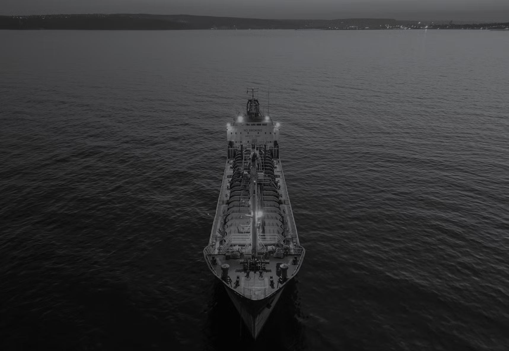
Dragonette-004: Hyperspectral intelligence from orbit

Nov 6, 2025
When Dragonette-004 joined orbit aboard SpaceX’s Transporter-13 mission, it marked an important milestone in Wyvern’s journey toward making hyperspectral intelligence accessible to the world.

Built and operated in collaboration with Loft Orbital, this satellite represents the continued growth of the Dragonette constellation, delivering rich, high-fidelity hyperspectral data to customers around the globe.

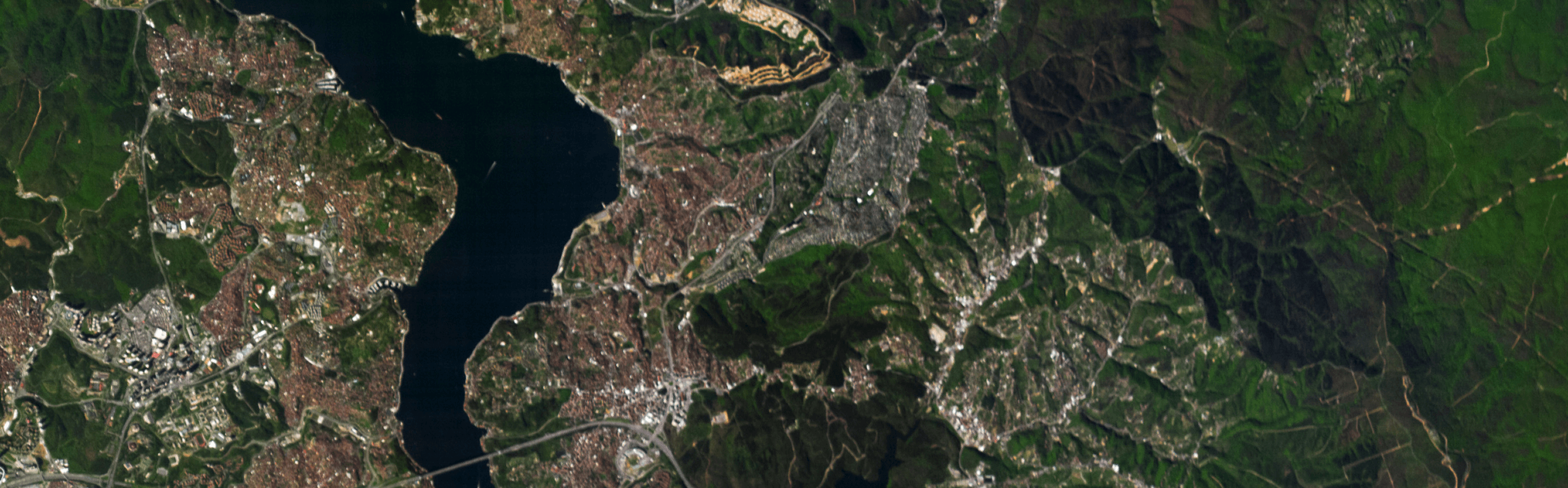
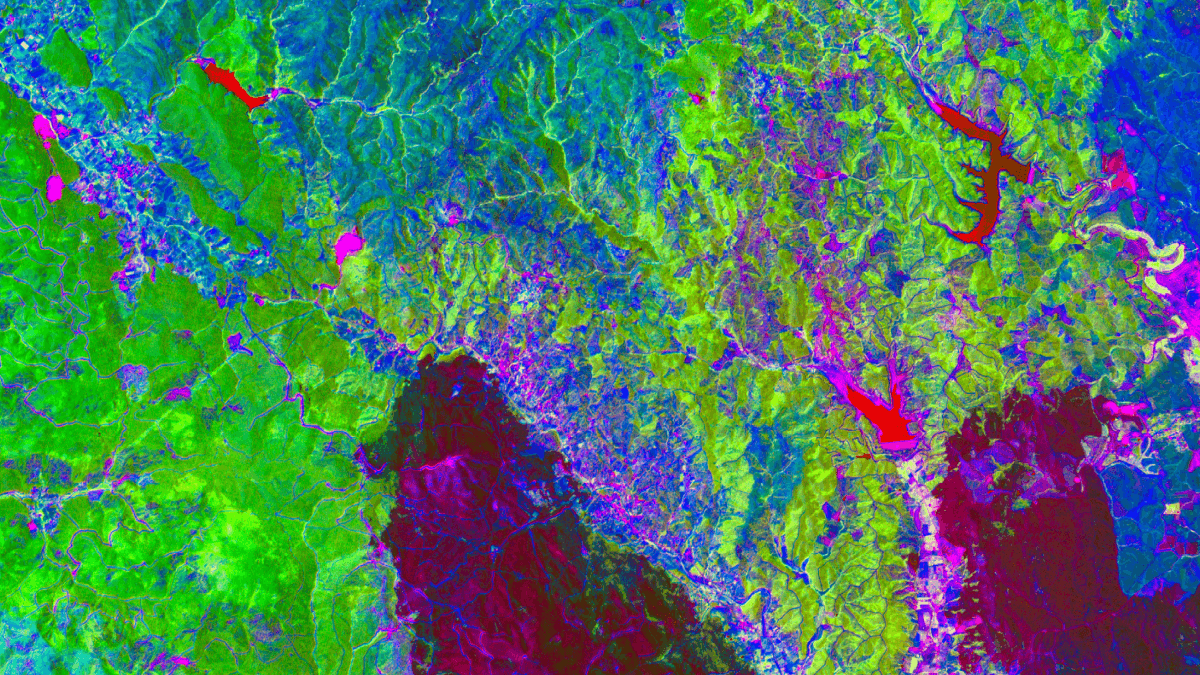
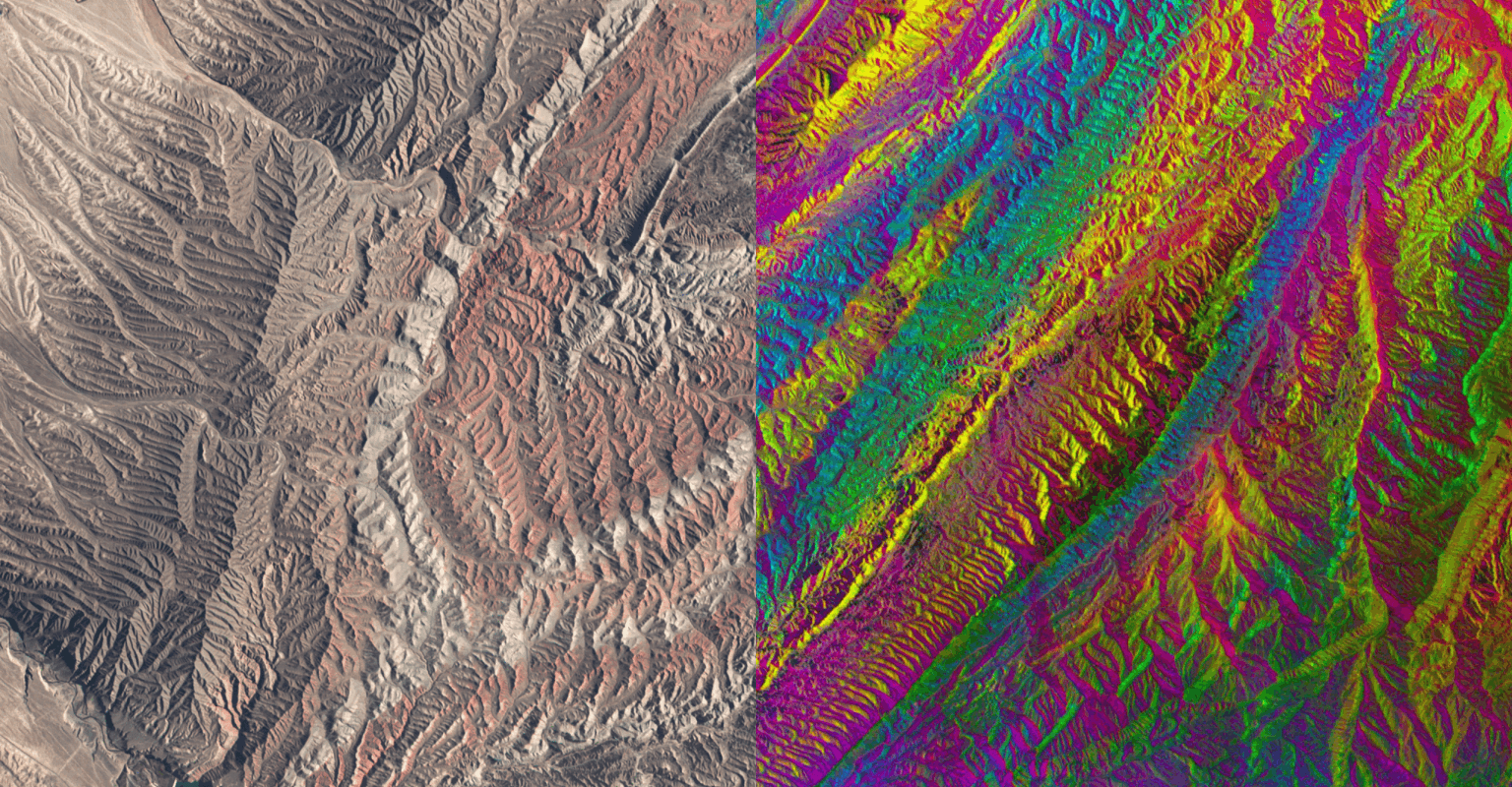
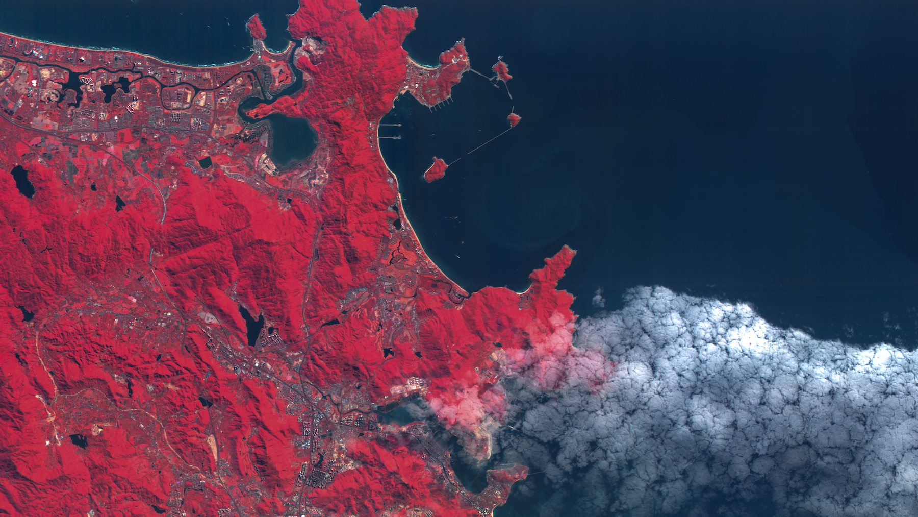
Today, Dragonette-004 is capturing stunning, information-dense imagery that reveals the world in remarkable detail. From vegetation health to water quality and coastal monitoring, each pixel contains spectral insights invisible to conventional imaging. These new images showcase the capabilities of Wyvern’s expanding constellation and the value of high-precision, space-based spectral data.

Hyperspectral view over the Okavango Delta in Botswana, shown in a PCA visualization (left) and RGB (right). ‍Image taken with Dragonette-004 on 2025-10-04 09:15:38 UTC.

Transforming How We See the World

When Wyvern was founded, we believed hyperspectral imaging could transform agriculture, forestry, energy, defence, and environmental management alike. But access to such data was rare, expensive, and technically complex. The Dragonette constellation changes that by delivering high-quality, ready-to-use hyperspectral imagery at scale.

Customers are already leveraging Wyvern data to:

  1. Monitor crop and vegetation health with unmatched precision.
  2. Identify tree species and map fuel loads to support wildfire mitigation.
  3. Assess ecosystem changes in water and coastal regions.
  4. Improve situational awareness and environmental intelligence in defence and security contexts.

With every new satellite, Wyvern expands capacity, increases revisit frequency, and strengthens the reliability of hyperspectral intelligence for real-world applications.

Tianshan Mountains west of Ürümqi, China, shown in RGB (left) and a stunning PCA visualization (right). ‍Image taken with Dragonette-004 on 2025-10-09 04:09:46 UTC.

Speaking of Capacity

Here’s what makes Dragonette-004 so important. It marks a shift away from small CubeSats toward more capable spacecraft platforms. Dragonette-004 has a significantly larger imaging and downlink capacity than Wyvern’s first three satellites, putting more data in customers’ hands, faster.

Alongside this greater capacity, the mission also demonstrates improvements in data latency and delivery performance, ensuring insights reach customers sooner. Thanks to our collaboration with Loft Orbital, Dragonette-004 benefits from advanced onboard systems and a streamlined tasking architecture designed for reliability and scalability.

Dragonette-004 is available to task now, with data already being delivered to customers across agriculture, forestry, and environmental monitoring sectors.

A Foundation for the Future

With Dragonette-004 in service and Dragonette-005 preparing to launch shortly, Wyvern’s constellation is scaling to meet the growing global demand for high-quality hyperspectral imagery.

Each new satellite adds capacity and resilience building toward a future where space-based hyperspectral imagery becomes essential to decision-making.

The view from space has never been clearer.

Interested in ordering hyperspectral data? Contact sales@wyvern.space or reach out here.

Share this post
Agriculture
Energy
Forestry and ESG
Mining
Peace and security
Tag one
Tag two
Tag three
Tag four

Related resources

View All

Blog title heading will go here

news
Nov 6, 2025
Category
5 min read

Blog title heading will go here

Lorem ipsum dolor sit amet, consectetur adipiscing elit. Suspendisse varius enim in eros.
Read more
Category
5 min read

Blog title heading will go here

Lorem ipsum dolor sit amet, consectetur adipiscing elit. Suspendisse varius enim in eros.
Read more

What We Learned Talking to Mining Operators About Reclamation

Insights
Feb 13, 2026

What We Learned Talking to Mining Operators About Reclamation

Insights
Feb 13, 2026

Hyperspectral Precision Agriculture: Fertilizer Optimization and Yield Forecasting by Wyvern x Messium

Whitepaper
Feb 1, 2026

Hyperspectral Precision Agriculture: Fertilizer Optimization and Yield Forecasting by Wyvern x Messium

Whitepaper
Feb 1, 2026

Hyperspectral Tree Species Detection by Wyvern x Tesera

Whitepaper
Nov 1, 2025

Hyperspectral Tree Species Detection by Wyvern x Tesera

Whitepaper
Nov 1, 2025
View All

Start using
hyperspectral imagery

And bring a new level of clarity to your operations.
Order imagery
Contact us
Products
Hyperspectral imageryArchiveOpen Data
Industries
AgriculturePeace and securityForestry and ESGEnergyMining
Company
Our technologyOur partnersAbout usJoin usContact us
Subscribe
Join our newsletter to stay up to date on all things Wyvern.
By subscribing you agree to with our Privacy Policy and provide consent to receive updates from our company.
Thank you! You are now subscribed!
Oops! Something went wrong while submitting the form.
© 2026 Wyvern Inc. All rights reserved.
Privacy Policy
We use cookies to enhance your experience.
Learn more
Accept