Wyvern launches Open Data Program to provide unrestricted hyperspectral data access

Simple access to hyperspectral data
Wyvern Inc., a Canadian space data company who was first-to-market with the highest resolution commercial hyperspectral data last year, launches its Open Data Program for the Earth observation community today to help accelerate testing and adoption of data for transformative applications across industry, government, and academia. This new Open Data Program provides free hyperspectral satellite imagery captured from Wyvern’s Dragonette hyperspectral satellite constellation under the flexible public release creative commons license (CC BY 4.0). The licensing structure allows unrestricted access and use of the data, as long as attribution credit is provided to Wyvern.
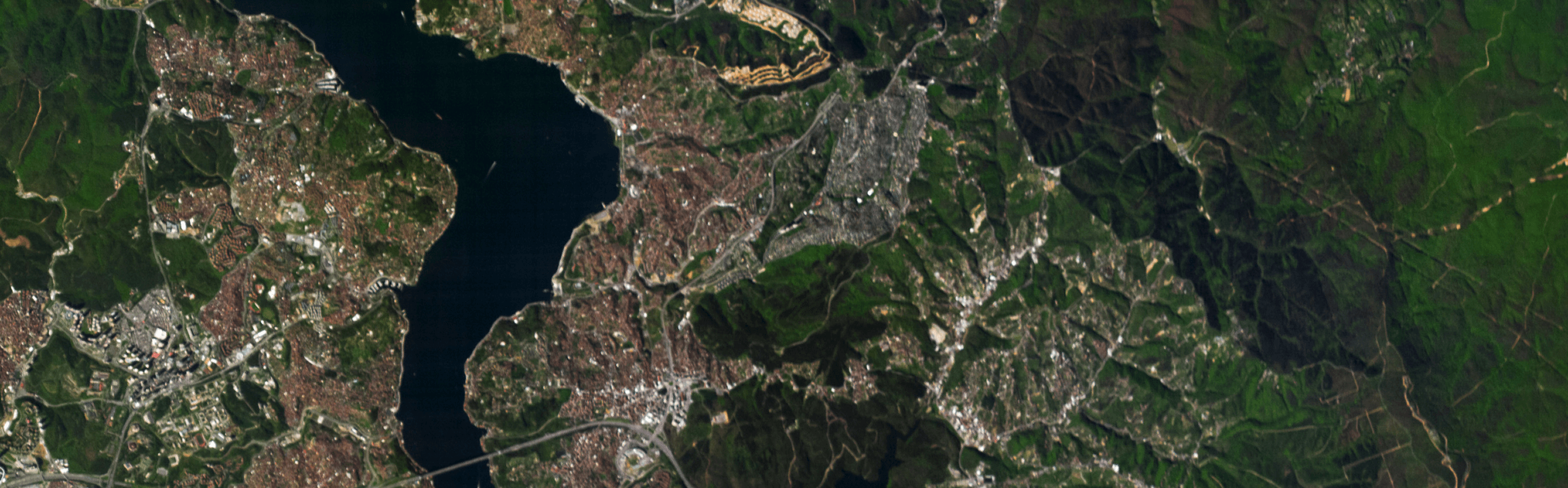
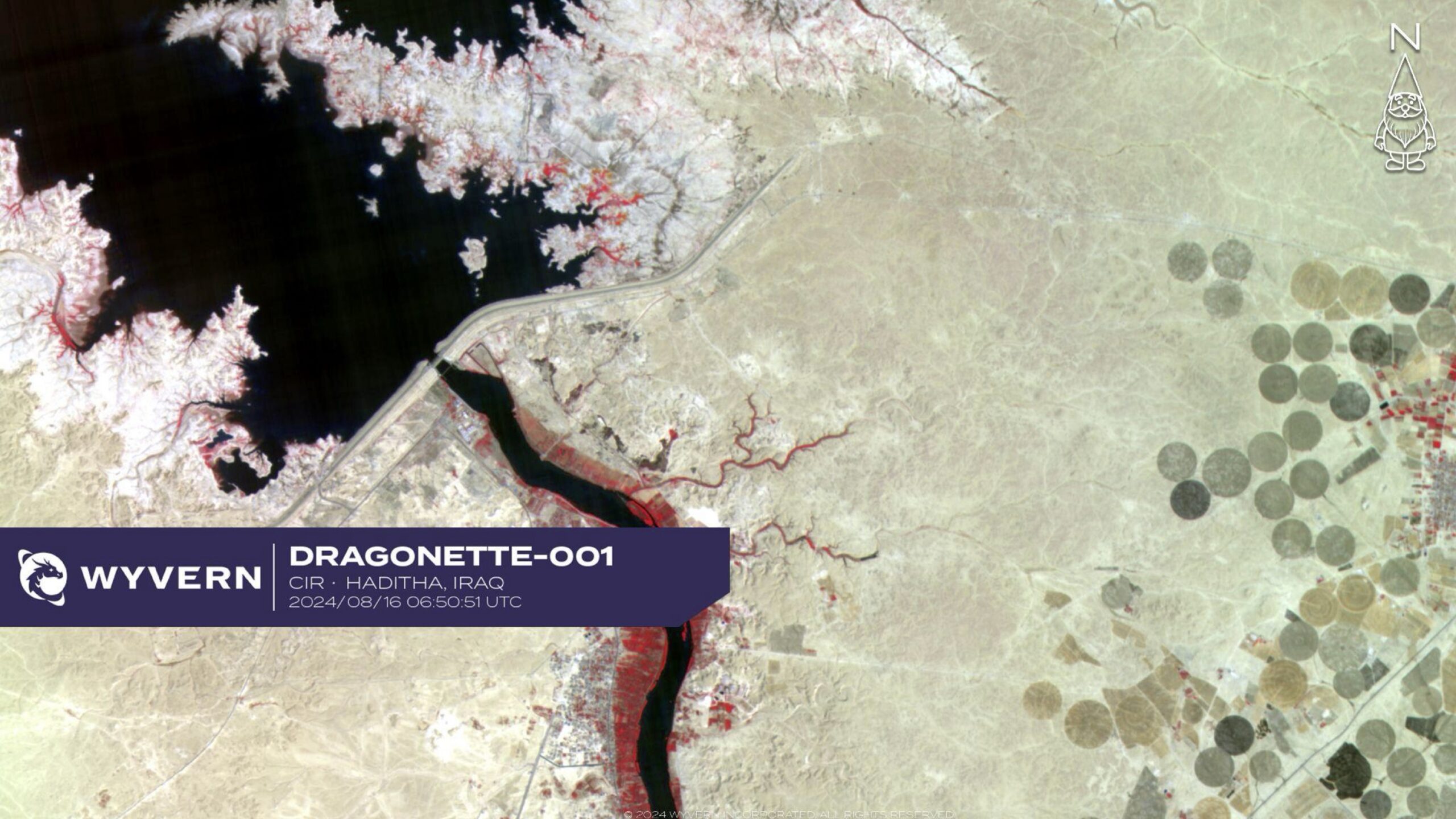
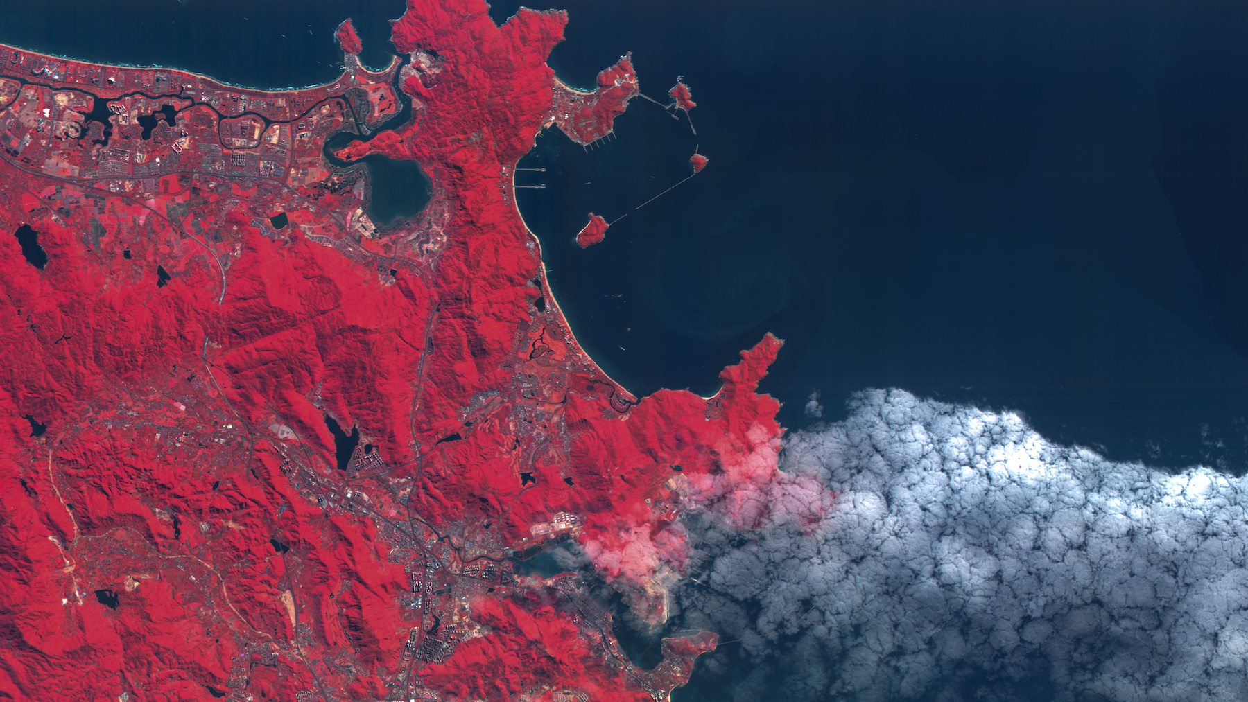
The initial release of the Open Data Program contains 25 images of various land cover features, including forests, wildfire events, pivot and row crop fields, coastal bathymetry, open pit mines, solar farms and well sites, from across the globe. These images can be accessed and downloaded directly from the Open Data Program site – no sign up required – to ensure data scientists, students, researchers and the like have simple access to hyperspectral data.
“We are thrilled to launch our Open Data Program, reflecting Wyvern’s commitment to foster innovation in the remote sensing community and demonstrate the power of hyperspectral imagery to help solve some of our most urgent global challenges,” says Adam O’Connor, Chief Product Officer at Wyvern. Wyvern has plans to continuously expand the Open Data Program as the Dragonette constellation collects more hyperspectral images of our world, including over areas of significant humanitarian events. Adam expanded, “We envision the Open Data Program as playing a crucial role in supporting our fellow humans in their time of greatest need by providing access to free Earth observation imagery for humanitarian assistance and disaster relief missions.” Collecting more open data to support disaster relief and other applications will be especially possible thanks to Wyvern’s fourth Dragonette satellite (Dragonette-004) launching in the first half of 2025.
Hyperspectral imaging plays a crucial role in environmental monitoring. Its ability to capture fine spectral details allows researchers, scientists, and decision-makers to make in-depth assessments of ecosystems, natural resources, and ecological changes. Because of this, an Open Data Program was a must-have from Wyvern’s inception. “Making data freely available for researchers and developers to experiment with has been a goal at Wyvern from the start. Inspired especially by the open data philosophy of our friends at Umbra, we believe the geospatial community will collectively benefit from data providers like Wyvern sharing imagery freely.” expanded Callie Lissinna, Co-Founder of Wyvern. “We created Wyvern to make Earth better from space, and we’re proud of how this Open Data Program contributes to that.”
"We created Wyvern to make Earth better from space, and we're proud of how this Open Data Program contributes to that."
– Callie Lissinna
Hyperspectral imaging plays a crucial role in environmental monitoring. Its ability to capture fine spectral details allows researchers, scientists, and decision-makers to make in-depth assessments of ecosystems, natural resources, and ecological changes. Because of this, an Open Data Program was a must-have from Wyvern’s inception. “Making data freely available for researchers and developers to experiment with has been a goal at Wyvern from the start. Inspired especially by the open data philosophy of our friends at Umbra, we believe the geospatial community will collectively benefit from data providers like Wyvern sharing imagery freely.” expanded Callie Lissinna, Co-Founder of Wyvern. “We created Wyvern to make Earth better from space, and we’re proud of how this Open Data Program contributes to that.”
Alongside the launch of the Open Data Program, Wyvern has updated their Knowledge Centre to include tutorials related to working with Wyvern data in ENVI, QGIS, ArcGIS, and others.
To access the Open Data Program, visit opendata.wyvern.space
For tips and tutorials, visit knowledge.wyvern.space
Have questions about the Open Data Program? Contact us here.
About Wyvern
Edmonton-based space data company Wyvern was created to provide hyperspectral data that will enable a sustainable future for humanity. Wyvern’s cutting-edge unfolding camera technology will make high-quality, high-resolution hyperspectral imagery from satellites affordable like never before, unlocking applications in new markets for the very first time. The company is proud to be carving a path for the Canadian space industry by providing the highest-resolution commercial hyperspectral imagery of the Earth available now. For more information about commercial uses of hyperspectral data, visit the Wyvern Knowledge Centre.


Start using
hyperspectral imagery